

Kore Aviation - When you look up and see an airplane cruising high above the clouds, have you ever wondered how the pilot knows exactly where to go? After all, there are no road signs in the sky. So, how do pilots navigate? The answer lies in a blend of flight planning, visual observation, satellite guidance, and radio communication.
Let’s walk through the exact steps pilots take to safely and confidently find their way across the sky.
1. Understanding Flight Planning: It Starts on the Ground
Before any flight takes off, the pilot creates a detailed plan for the trip. This is called flight planning, and it includes:
- Mapping out the route from departure to arrival
- Calculating how much fuel is needed based on distance and wind
- Checking weather conditions along the route
- Identifying backup airports in case of an emergency
- Reading temporary flight notices that warn of hazards (called NOTAMs)
Flight planning is like setting your GPS before a long road trip. It helps pilots prepare for every step of the journey before even stepping into the cockpit.
Also read: How Long Is Pilot Training and What to Expect on Your Flight Path?
2. Visual Navigation: Looking Out the Window
For shorter flights or clear weather days, pilots often use a method called visual flying. They rely on what they can see outside, such as rivers, roads, mountains, and buildings to stay on track. This is especially common during daytime flying when visibility is high.
This technique is called pilotage, and it is often taught to beginner pilots. It helps them learn to read maps and match landmarks on the ground to their position in the air.
3. Using Time and Distance: Estimating Your Position
Another traditional method is called dead reckoning. This involves estimating your position based on:
- Your current direction (or heading)
- Your airspeed
- How long you’ve been flying
Pilots calculate how far they should have traveled based on these details, even without checking outside or using technology. It is an excellent backup method in case other tools fail.
Discover More: How Hard Is It to Become a Pilot?
4. Radio Signals From the Ground: Tuning into the Sky
Many airports and air traffic towers send out special radio signals that pilots can use for navigation. Two common systems are:
-
VHF Omnidirectional Range (VOR):
VOR stations send out signals that help pilots figure out which direction they are from that station. Pilots tune into the signal to stay on course. -
Distance Measuring Equipment (DME):
DME tells pilots how far they are from a station, helping confirm their exact location.
These tools are reliable and widely used, especially when weather limits visibility. Pilot use aviation headset to hear every navigation and instruction clearly.
Check out Kore Aviation premium and affordable headsets. Designed for durability and clarity for flights.

5. Satellite Navigation: Modern GPS in the Sky
Today, most aircraft rely on Global Positioning System (GPS) technology. Just like your smartphone’s GPS helps you find your way on the road, airplane GPS systems guide pilots along exact routes.
This technology allows for direct flights, which means fewer turns, shorter distances, and better fuel efficiency. It’s accurate, fast, and used worldwide.
In more advanced planes, pilots use something called Area Navigation (RNAV). RNAV lets aircraft follow a route based on GPS, rather than relying on signals from radio towers. This method improves air traffic flow and allows for smoother flights.
Why Backups Are Critical: When Systems Fail
Pilots are trained to never rely on just one tool. In case the GPS stops working, or visibility becomes poor, they always have backups ready:
- Maps and flight charts
- Visual checkpoints on the ground
- Radio navigation tools like VOR and DME
- Communication with air traffic controllers
Pilots also use checklists and follow specific procedures to ensure they stay safe and know what to do in every situation.
Read More: What Aviation Survival Equipment Do Pilots Need to Stay Safe?
Navigating Through Weather: Rules for Different Skies
There are two types of rules pilots follow based on the weather:
-
Visual Flight Rules (VFR):
These are used when weather is clear, and pilots can see the ground and other aircraft. -
Instrument Flight Rules (IFR):
Used when the weather is poor, or at night, when pilots rely on instruments inside the cockpit. They follow directions from air traffic control and fly assigned paths.
Navigation Under Different Conditions
| Condition | Navigation Methods Used |
|---|---|
| Good weather VFR flights | Pilotage + visual landmarks + basic instruments |
| Night VFR or poor visibility | Radio navigation + GPS |
| IFR in clouds or low visibility | Ground based aids + GPS RNAV + ATC instructions |
| Long cross country flights | GPS, RNAV, waypoints, autopilot for route following |
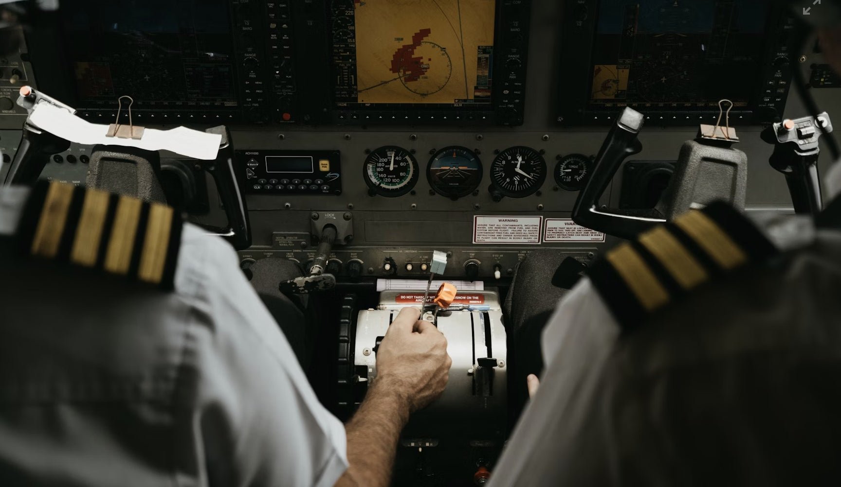
Navigation Tools in the Cockpit
Here’s a list of some of the tools pilots use during flight:
- Flight map display
- GPS unit
- Compass
- Altimeter (shows altitude)
- Airspeed indicator
- Radio tuner (for VOR or airport communication)
And most importantly, they use a high-quality aviation headset to hear every instruction clearly.
Which Aviation Headset Is Right for Beginner Student Pilots?
Pilot FAQs: Answering Your Navigation Questions
-
How do pilots know where they are if they can’t see the ground?
They use instruments like GPS, radio signals, and cockpit displays to track their position accurately. -
Can pilots fly without GPS?
Yes. Pilots are trained to use maps, visual checkpoints, and ground radio signals if GPS fails. -
What happens if the weather suddenly changes?
Pilots switch to instrument flying and follow instructions from air traffic control to stay safe. -
Is navigation different at night?
Yes, at night pilots rely more on instruments, radio signals, and cockpit lighting. Some use lighted landmarks on the ground if visible. -
Do student pilots learn these techniques?
Absolutely. Instructors teach student pilots every method, visual flying, GPS, and radio navigation to prepare for real flight situations. -
Can pilots fly solely using GPS?
Yes many flights now use GPS for primary navigation but backups are always ready in case of failures. -
What is RNAV?
RNAV stands for area navigation. It allows aircraft to fly direct routes between waypoints rather than using only radio nav aids. -
Do pilots still learn VOR navigation?
Yes. It remains a required skill especially for IFR operations or as backup when satellite navigation degrades. -
Is visual navigation enough for long flights?
Not always. Visual navigation works well in good weather but over oceans or mountains or during night one must use instruments or radio navigation. -
How they maintain positional awareness in clouds or IMC?
They rely on instruments, radio nav aids ATC guidance and GPS RNAV. They do not rely on visual cues in those conditions. -
What tools are mandatory?
Requirements differ by aviation rules and aircraft but common ones include GPS or suitable RNAV system VORs and radio navigation aids and charts.
Call to Action: Fly Smarter With Kore Aviation
Clear communication is a critical part of safe navigation. Whether you’re a student pilot learning the basics or a certified pilot preparing for long cross-country flights, using a reliable aviation headset can make a huge difference.
Check out Kore Aviation's headset collection for gear trusted by pilots at every level.
Final Thoughts
Navigation is more than just following a line in the sky. It’s about preparation, awareness, and using the right tools. Whether it’s a sunny afternoon with clear visibility or a night flight through the clouds, pilots have multiple ways to stay on course.
So next time you look up and see a plane overhead, you’ll know it’s guided by more than just instinct. It’s a combination of smart planning, sharp tools, and constant communication.


